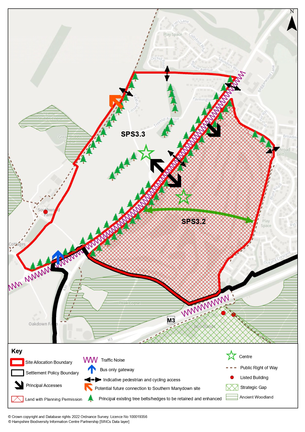
Policy SPS5.2: Basingstoke Golf Course
The site, as shown on the Policies Map, is allocated for a well designed and sustainable development that will:
-
Make provision for approximately 1,000 dwellings;
-
Be in accordance with the principles of the Concept Plan and the Basingstoke Golf Course Development Brief Supplementary Planning Document (2019);
-
In addition to the mix of dwelling sizes and types, make provision for a proportion of self-build units and also, in conjunction with other sites, a permanent, pitch/plot provision to meet identified accommodation needs of Gypsies, Travellers and Travelling Showpeople in the borough, such needs being identified in the council’s Gypsy and Traveller Accommodation Assessment (and any updates);
-
Include the provision of social and physical infrastructure, including the provision of a community centre, local shopping facilities, and sports facilities including playing pitches with adequate land to meet the outdoor sports needs of both this site and the development on Hounsome Fields with an Infrastructure Delivery Strategy to demonstrate that the needs of the development sites in south-west Basingstoke have been comprehensively planned and will be met;
-
Respond positively to the special characteristics and sensitivities of the landscape and respect its location, providing for integration with nearby residential areas;
-
Avoid or mitigate direct and indirect adverse impacts on key species and habitats, including the adjacent Peak Copse Site of Importance for Nature Conservation through adequate buffering, ensuring the retention of key woodland areas and less managed grasslands and by mitigating and/or compensating any adverse impacts to ensure a net gain in biodiversity. Opportunities will be taken to create and enhance habitat connectivity between existing key habitats;
-
Include measures to mitigate the impact of development on the local road network including improvements to the A30 corridor;
-
Provide all-purpose vehicular accesses from both Winchester Road (A30) and Beggarwood Lane supported by emergency accesses, ensuring that the most appropriate location for access from the A30 is identified, taking into account the requirement to access Hounsome Fields (Policy SPS5.3);
-
Prevent ‘rat-running’ through the site between Beggarwood Lane and Winchester Road (A30) by including measures and/or designing the road layout to discourage the passage of through traffic;
-
Include measures to improve accessibility by non-car transport modes, including the provision of internal walking and cycling routes linked to existing external routes, the Public Rights of Way network, and the Strategic Cycle Network, with direct access to the town centre, and facilitating improved access towards Dummer, improving the links to the existing Winchester Road bus stops, and providing safe and convenient crossing points to facilities provided on Hounsome Fields (Policy SPS5.3);
-
Ensure the provision of public transport from the outset;
-
Ensure adequate infrastructure is provided for sewerage (on and off site) and surface water drainage and produce a drainage strategy;
-
Avoid development and points of access in the small area of the site within flood zone 2;
-
Include appropriate open space/green infrastructure, including allotments, to meet local needs in line with the council’s adopted standards, providing links to the existing green infrastructure network;
-
Ensure acceptable noise standards can be met within homes and amenity areas through suitable noise mitigation measures in light of the proximity of the site to the A30 and M3;
-
Incorporate and/or promote renewable and low carbon energy technologies.
-
Ensure, through joint masterplanning, and joint infrastructure planning, that it provides a comprehensive development with and Hounsome Fields (Policy SPS5.3).
|
